$7,997.00
1.18 acres | Residential Zoning
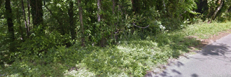
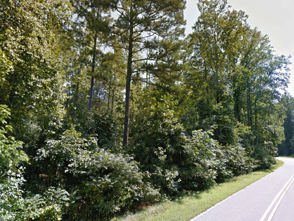
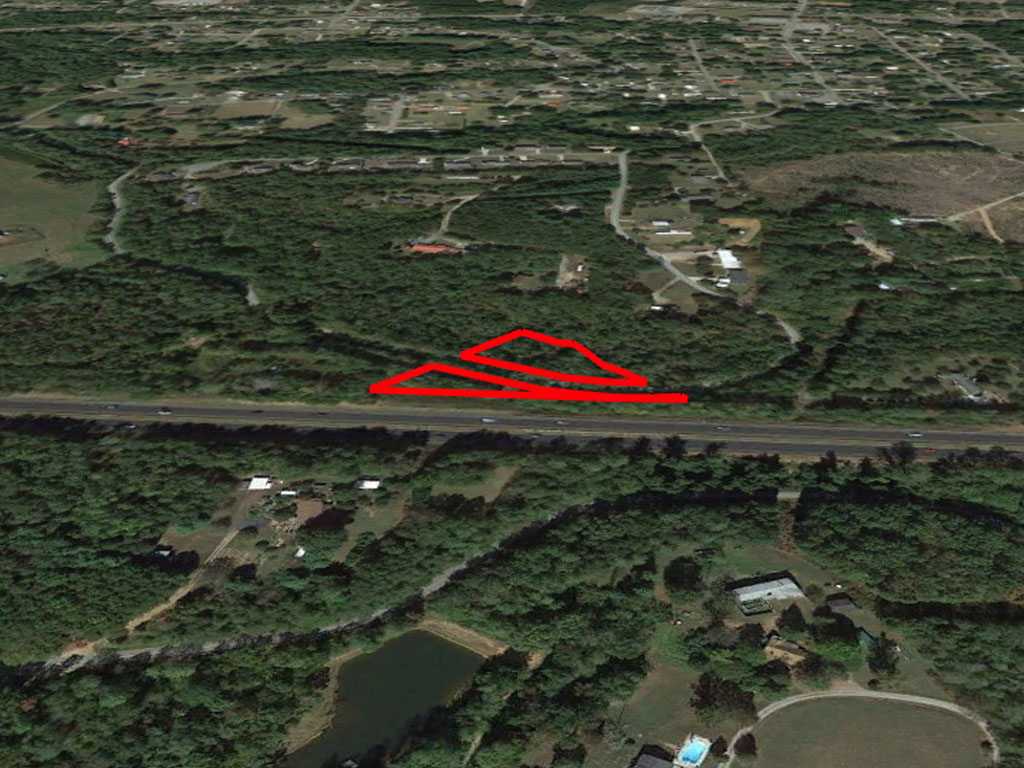
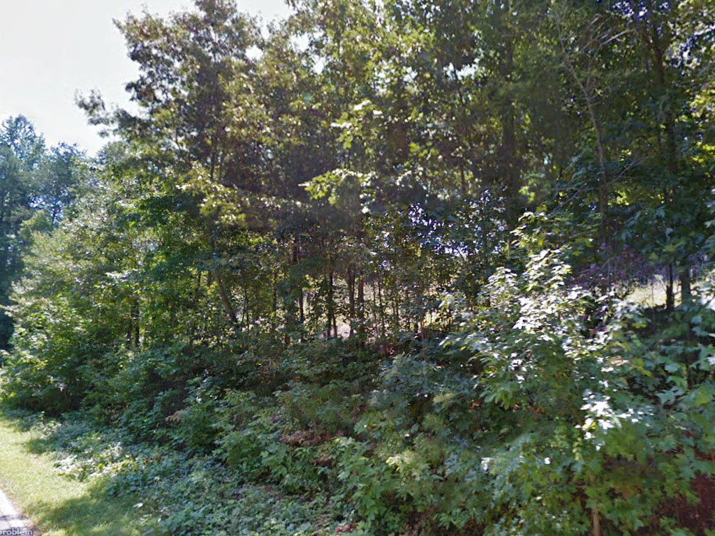
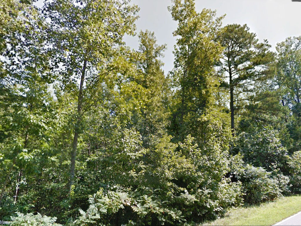
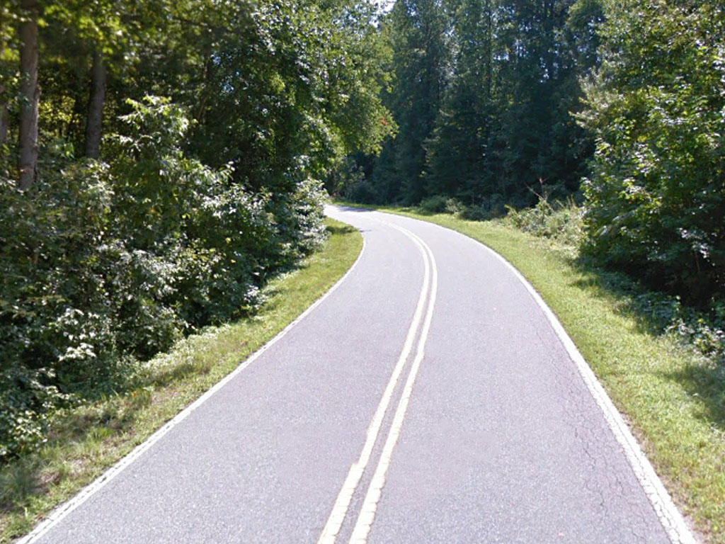
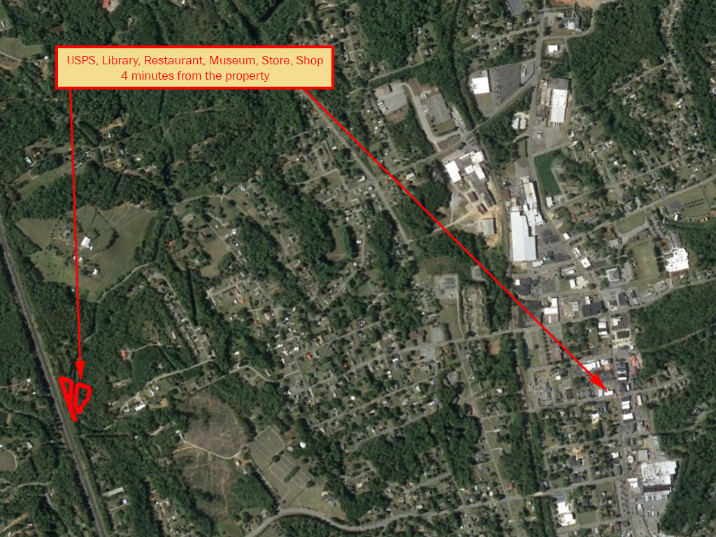
Just over an acre near Rhodhiss lake. This lot is close to the highway and just over an hour to Charlotte and four minutes to Valdese. There are other homes in the area and the property is surrounded by beautiful trees. There are multiple state parks near the property including South Mountains State Park and Lake James. Experience the foothills of North Carolina and make this property yours today.
Land Specifics
| Property Number | 12749 |
|---|---|
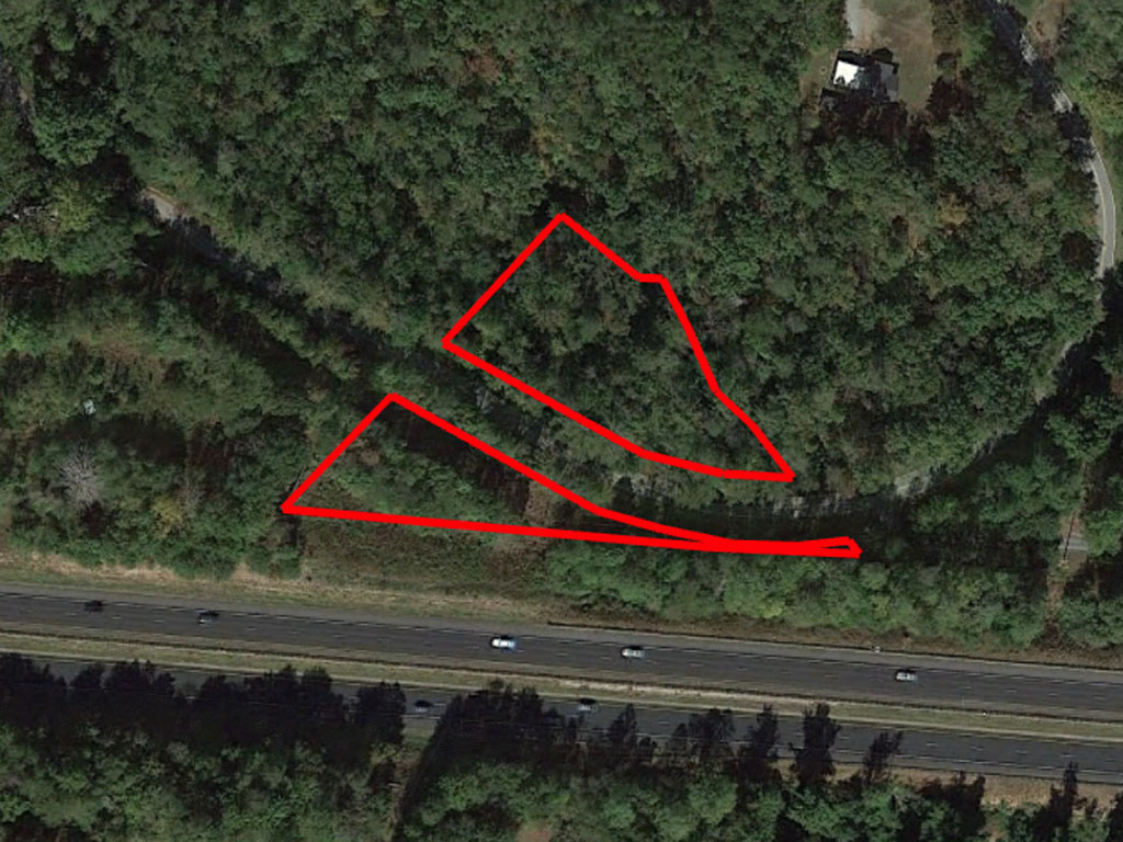
| Size | 1.18 acres |
| Dimensions | 150'x 81.53'x 22'x 40'x 77'x 28'x 49.75'x 55.63'x 325' and 155'x 410'x 514.2' |
| Road Access | Paved Road |
| Slope Description | Rolling |
| Zoning | Residential |
| Zoning Code | R1 (Residential District) |
| Zoning Definition |
R1 (Residential District): The R-1 Residential District is intended to be limited exclusively to single-family site built and modular dwelling units. The characteristics of the district, and the uses allowed there, are primarily residential in nature. The regulations of this district are intended to discourage any use that, because of its character, would substantially interfere with the development of single family residences, and which would be detrimental to the quality of life that appeals to the average resident of this county. |
| On Property Usage/Potential |
|
| Nearby Usage |
|
Location
| County | Burke |
|---|---|
| State | North Carolina |
| Other Maps |
|---|
Additional Information
| Assessor Parcel Number (APN) | 32897 AND 4635 |
|---|---|
| Estimated Annual Taxes | $35.62 |
| Legal Description |
Located in Lovelady Township, Burke County, North Carolina, and described as follows: (Parcel 1): BEGINNING at an iron pipe located in the right-of-way of I-40, said beginning point being located in the southeast corner of the Norman McLean property, and running thence with the east margin of the Mclean property and crossing S. R. 1731 North 49º 28’ 36” East 357.09 feet to an iron pipe located on the bank of the creek, thence continuing the same course 7.00 feet to the center of the creek; thence with the center of the creek and with the south margin of the Woodrow Smith and Rector tracts, the following courses and distances: South 45º 32’ 30” East 81.53 feet; North 89º 54’ 25” East 21.74 feet; South 33º 52’ 37” East 39.22 feet, South 15º 06’ East 76.49 feet; South 44º 31’ 20” East 49.75 feet, South 31º 34’ 55” East 55.63 feet; South 31º 18’ 35” East 86.34 feet to an iron pipe located in the right-of-way of I-40, said pipe being located North 80º 39’ West 69.66 feet from a concrete right-of-way monument, thence with the right-of-way of I-40 North 80º 39’ West 514.20 feet to the point of BEGINNING and containing 1.74 acres more or less AND (Parcel 2): BEGINNING at an iron pipe located in the right-of-way of I-40, said beginning point being located in the southeast corner of the Norman McLean property, and running thence with the east margin of the Mclean property and crossing S. R. 1731 North 49º 28' 36" East 357.09 feet to an iron pipe located on the bank of the creek, thence continuing the same course 7.00 feet to the center of the creek; thence with the center of the creek and with the south margin of the Woodrow Smith and Rector tracts, the following courses and distances: South 45º 32' 30" East 81.53 feet; North 89º 54' 25" East 21.74 feet; South 33º 52' 37" East 39.22 feet, South 15º 06' East 76.49 feet; South 44º 31' 20" East 49.75 feet, South 31º 34' 55" East 55.63 feet; South 31º 18' 35" East 86.34 feet to an iron pipe located in the right-of-way of I-40, said pipe being located North 80º 39' West 69.66 feet from a concrete right-of-way monument, thence with the right-of-way of I-40 North 80º 39' West 514.20 feet to the point of BEGINNING and containing 1.74 acres more or less. |
| Monthly HOA Dues | $0 |
| HOA | |
| HOA Dues | $0 |
| HOA Info |
This property has been sold.
This property is no longer available.
Use My LandCentral to be notified when a similar property is available in the future.
Or search available properties now:
Search Properties