$5,920.00
1.17 acres | Not_zoned / Unclassified Zoning
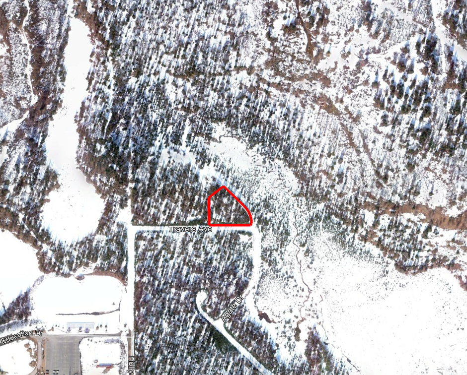
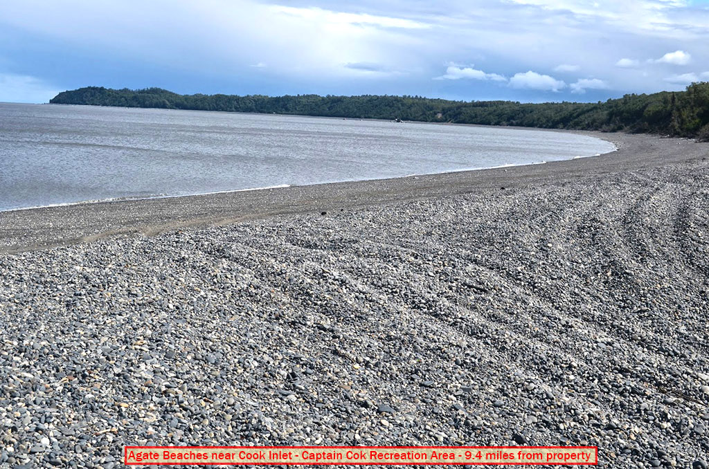
Lot One (1) Block Four (4), according to the Plat of AGATE BEACH SUBDIVISION, filed under Amended Plat No. 84-202, in the Kenai Recording District, Third Judicial District, State of Alaska, which lot is identified as Tax Map No. 013-141-31.
Land Specifics Foreclosed
| Property Number | 7566 |
|---|---|
| Size | 1.17 acres |
| Dimensions | 187.72' x 114.66' x 208' x 118.87' x 31.44' x 257.56' |
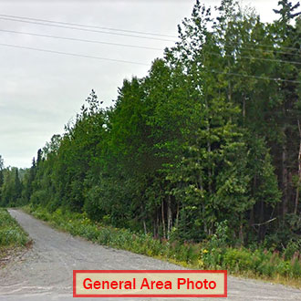
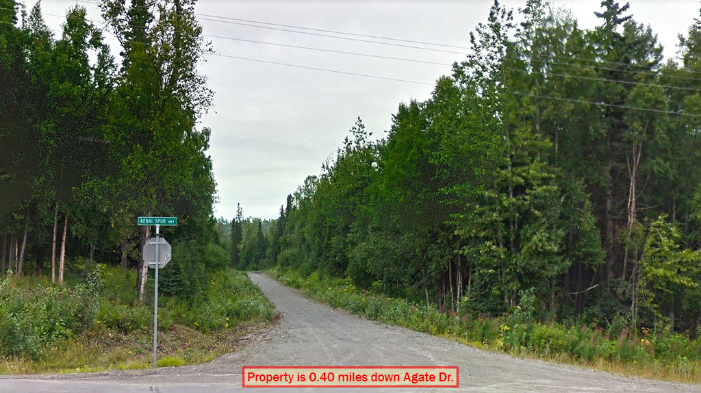
| Road Access | Dirt Road |
| Slope Description | Mostly Flat |
| Zoning | Not_zoned / Unclassified |
| Zoning Code | Not Zoned |
| Zoning Definition |
Alaska does not zone properties outside of local option zoning areas. |
| On Property Usage/Potential |
|
| Nearby Usage |
|
Location
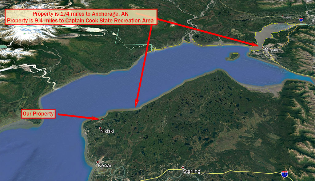
| County | Kenai Peninsula |
|---|---|
| State | Alaska |
| Other Maps |
|---|
Additional Information
| Assessor Parcel Number (APN) | 013 141 31 |
|---|---|
| Estimated Annual Taxes | $68.68 |
| Legal Description |
Lot One (1) Block Four (4), according to the Plat of AGATE BEACH SUBDIVISION, filed under Amended Plat No. 84-202, in the Kenai Recording District, Third Judicial District, State of Alaska, which lot is identified as Tax Map No. 013-141-31. |
| Monthly HOA Dues | $0 |
| HOA | |
| HOA Dues | $0 |
| HOA Info |
This property has been sold.
This property is no longer available.
Use My LandCentral to be notified when a similar property is available in the future.
Or search available properties now:
Search Properties